
Download Drummond Gravel Routes Map
Download Drummond Gravel Routes GPS Tracks
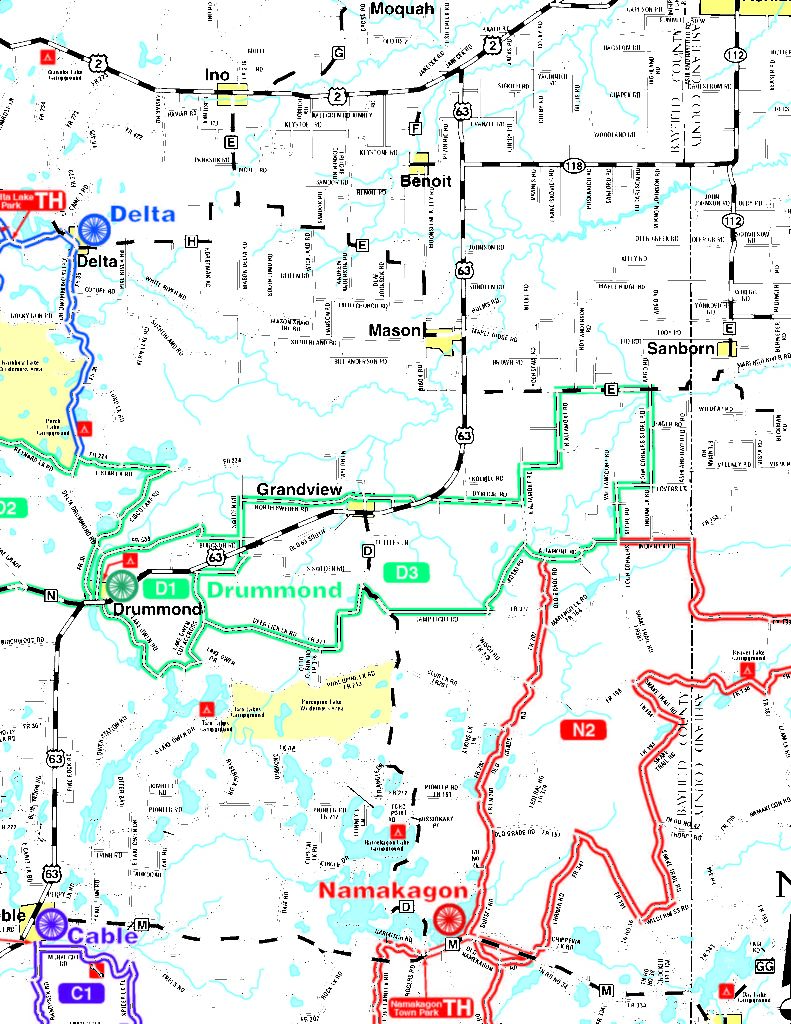
ROUTE DESCRIPTIONS
Starting Point: Drummond Town Park
D1 – 15 miles with 505 feet of climbing. This is relatively easy route
that heads north on an old railroad grade, crossing the North
Country Trail. Take notice of the gigantic trees along this section.
There are sections of pavement including N. Lake Owen Drive with
some short steep hills, but the scenery is amazing.
D2 – 20 miles with only 557 feet of climbing. A relatively easy route
with a couple of quiet paved roads on Hwy N and Delta Drummond
Road. The route passes among dozens of beautiful lakes and
streams and takes you near the site of the former Pigeon Lake CCC
Camp.
D3 – 46 miles with 1,781 of climbing. A local favorite, the first section
of this route runs along an abandoned railroad grade, crosses the
North Country Trail and passes through a section of old growth
forest. There are a few long hills and amazing views of dozens of
lakes and streams as you near the town of Grand View. The route is
primarily gravel with no services along the way, although you could
ride into Grand View.
After your ride, stop by the Four Corners Store at the intersection of
Cty E and Four Corners Store Road for some refreshment.