
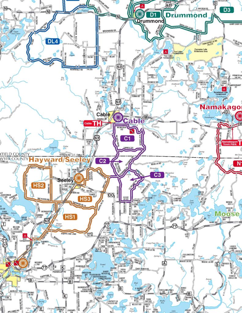
Download Cable Gravel Route Map
Download GPS tracks
You will be re-directed to a Google Drive page where you will be able to download selected tracks.
ROUTE DESCRIPTIONS
Starting Point: CAMBA Cable Trailhead-Town of Cable Municipal Parking
C1 – 12 miles with 626 feet of climbing and some sustained climbing
and a few steep hills, especially on Randysek Road and Timber Trail.
C2 – 25 miles with 1,437 feet of climbing and a few steep hills on Timber
Trail and Randysek Road. Predominately gravel with short sections of pavement.
C3 – 31 miles with 1,700 feet of climbing including some long climbs.
Short stretches on quiet pavement. Some of the gravel can be sandy
and rough. Approaching Seeley you will ride a couple of miles on the
railroad grade, which is also an ATV trail – please exercise caution.
On routes C2 & C3, check out the site of the former Camp Smith Lake
CCC Camp on Telemark Rd. near Camp Smith Lake. Several building
foundations can still be seen from the road or via a short walk.